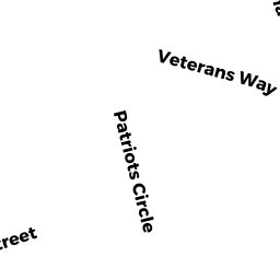
3 FERRY ST
Owner Information
DELTORCHIO JOHN III DELTORCHIO
3 FERRY ST
GLOUCESTER, MA 01930


Property Details
3 FERRY ST is classified as a Single Family Residential (Colonial).
The primary structure on this property was built in 1930. There are 3,314ft2 of built area within this property. There is 2,105ft2 of residential/living space within this property.
3 FERRY ST is valued at $540,000. The land is valued at $166,000 and the structures are valued at $368,400. There is an additional valuation of $5,600 on this property.
This property is in Zone R-10. Confirm with local Zoning Board authorities to ensure there are no overlays or other easements on this property.
The most recent deed for 3 FERRY ST is recorded at the local registrar in Book 9938, Page 270. 3 FERRY ST was last sold on Monday, March 27, 1989 for $219,000.
Assessment data from fiscal year 2022.
Flood Data
According to the FEMA National Flood Hazard Layer, this property does not appear to be in a flood zone. It may also be in an area not yet reviewed. Nonetheless, confirm this information prior to taking any action.
To view the flood hazards around this property, create a FEMA "Firmette" Map of the area around 3 FERRY ST.
Broadband Internet Providers
| Provider | Type | Bandwidth (mbps) | |
|---|---|---|---|
| Comcast | Cable | 1000 | 35 |
| T-Mobile | Fixed Wireless | 25 | 3 |
| GCI Communication Corp. | Satellite | 0 | 0 |
| HughesNet | Satellite | 25 | 3 |
| VSAT Systems, LLC. | Satellite | 2 | 1 |
| Viasat Inc | Satellite | 100 | 3 |
| Verizon New England Inc. | DSL | 7 | 0 |
Broadband service provider data from December 2020.
Adjacent Properties
- 6R RIVERVIEW RD
MUN VAC owned by GLOUCESTER CITY OF - 302 WASHINGTON ST
CH SERVICES CONDO owned by ADDISON GILBERT HOSPITAL - 302 WASHINGTON ST
CH SERVICES CONDO owned by NORTHEAST HOSPITAL CORPORATION - 302 WASHINGTON ST
CH SERVICES CONDO owned by NORTH SHORE COMMUNITY HEALTH INC - 302 WASHINGTON ST
Other, Open Space owned by RIVERDALE PROFESSIONAL BLDG CONDO ASSOC - 302 WASHINGTON ST
CH SERVICES CONDO owned by NORTHEAST HOSPITAL CORPORATION - 5 FERRY ST
Single Family Residential owned by ANDREW NANCY M - 9A FERRY ST
Undevelopable Residential Land owned by DELTORCHIO III JOHN & LISA B - 7 FERRY ST
Single Family Residential owned by DELTORCHIO JOHN III & DELTORCHIO - 1 FERRY ST
Single Family Residential owned by MURRIN DANIEL J MURRIN LISA A